
When NASA’s Apollo 8 crew circled the far side of the moon in 1968 and astronaut Bill Anders snapped a photo of Earth peeking out above the gray horizon, the image became a symbol of hope in troubled times. This photo, which became known as Earthrise, helped inspire the first Earth Day celebration two years later.
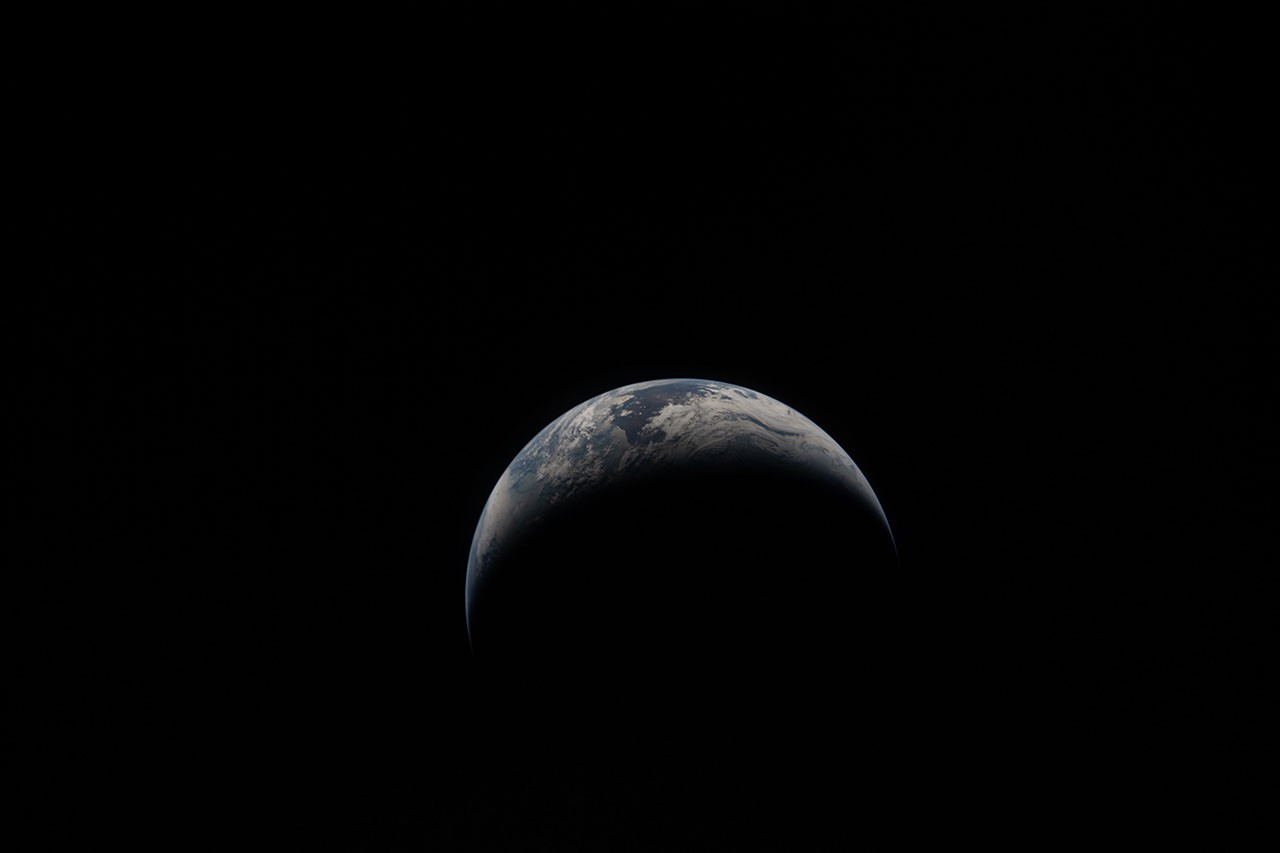
This year, astronauts on the Artemis II mission took some touching photos of their homeland. Newly released photos show Earth on April 6, when the crew traveled further than any human before.
“On Earth Day, we are reminded of our extraordinary responsibility to understand our planet,” said NASA Administrator Jared Isaacman. “NASA’s Earth science missions continue to provide critical data that strengthens communities, supports industries like agriculture, and helps the nation predict and respond to wildfires, droughts, floods, and other natural disasters. NASA is committed to working with our Earth science partners to advance our understanding of our planet.”
Imaging technology has come a long way since 1968, from cameras pressed against spacecraft windows to the most powerful radars ever flown, but the drive to understand our home in the universe remains.
“Artemis II’s four astronauts, Reed, Victor, Christina and Jeremy, took humanity on a journey and showed us just how special and bright Earth is, even from the far side of the moon. This is especially worth celebrating on Earth Day,” said Nikki Fox, associate administrator for the Science Mission Directorate at NASA Headquarters in Washington. “When you look at the stunning images of the blue marble planet through time, from Apollo 8’s Earthrise to Artemis II’s Earthset, it’s not only a moment of iconic beauty, but like other images captured during the lunar flight, the Earthset is full of incredible science in high resolution that will help inform future Artemis missions on the moon.”
Here’s a look at how NASA’s view of Earth has evolved since its earliest images of Earth.
In 1968, during 120 revolutions around the Earth, the Apollo 7 astronauts took a photo of New Orleans visible among the green swamps and tan sediments of the Mississippi River Delta some 95 nautical miles below. Radar in space is now revealing how the Earth beneath our feet is rising, sinking, and sliding.
Launched by NASA and the Indian Space Research Organization (ISRO) in July 2025, NISAR (NASA-ISRO Synthetic Aperture Radar) L-band and S-band SAR instruments can penetrate through clouds and tree canopies to reveal details and observe changes on the Earth’s surface. This is practical information for communities, including low-lying cities, at risk of losing ground due to rising sea levels and land subsidence.
The NISAR mission continues a long tradition of Earth observation satellites. NASA’s satellite records have been documenting changes in humans and the natural world for decades around the world, from ice to deserts. See how the recently launched PACE (Plankton, Aerosols, Clouds, and Marine Ecosystems) satellite captured the Mississippi River Delta, teeming with marine life.
“Artemis’ photos shared with all of humanity the breathtaking beauty of our home planet that can only be seen from space,” said Karen St. Germain, director of NASA’s Earth Sciences Division. “NASA’s Earth science satellite constellation provides an additional dimension to this beauty, teaching us how our Earth supports the vibrant and dynamic forms of life found on Earth. This data and discovery helps us deliver actionable science so we can continue to thrive on our ever-changing planet.”
The Himalayas have fascinated astronauts since the early days of the space age. Equipped with a handheld 70mm Hasselblad camera, L. Gordon Cooper photographed Mount Everest and its towering neighbors while orbiting the planet 22 times alone in a Mercury Atlas 9 capsule in 1963.
By the early 1990s, scientists were using radar aboard the Space Shuttle to track the mountain range’s peaks and valleys in incredible detail. More recently, other space missions and instruments such as ASTER (Advanced Spaceborne Thermal Emission and Reflection Radiometer) and Landsat have supported high-altitude exploration. These helped scientists pinpoint the location of deadly avalanches on Mount Everest and track changing plant ecology on some of the most remote slopes on Earth.
The launch of Artemis II on April 1 marked another milestone, exactly 66 years after its launch. TIROS-1, the world’s first successful weather satellite, carried a pair of television cameras and a magnetic tape unit when it was rocket-launched into low Earth orbit in 1960. The satellite provided weather forecasters with images of cloud cover from space, improving storm predictions.
Satellite data complemented the unique photographs taken by Apollo astronauts, documenting hurricanes, thunderclouds, and other storms raging beneath our feet. That work continues to this day. Next year, a new generation of radars will fly as part of the INCUS (Convective Updraft Survey) mission. Three small satellites flying in tight formation will help understand why, when, and where severe tropical thunderstorms, heavy rain, and clouds occur.
See how water monitoring satellites tracked another type of natural disaster, a tsunami, that hurtled across the Pacific Ocean after last July’s massive earthquake off the coast of Russia.
The images above capture two very different spectacular icescapes.
The snapshot on the left, taken by the Skylab space station crew in 1974, shows a plume of live ice near Belle Isle off the coast of Newfoundland. On the right, an aerial photo taken during Operation Icebridge, NASA’s longest airborne mission to observe ice in the Arctic and Antarctic regions, shows new sea ice forming along the coast of Antarctica. The mission’s discoveries and satellite laser data have helped scientists track changes in polar ice sheets since 2003.
In the Arctic, satellites continually monitor how much sea ice retreats from season to season and from year to year, documenting decades-long trends in ice cover decline. On the other side of the world, at Antarctica, NASA’s MODIS (Moderate Resolution Imaging Spectroradiometer) instrument recently captured the start of summer in full color.
Painting the Earth as blue marble is only part of our story. The Earth at night can also teach us a lot about humanity. Sensors orbiting our planet can resolve light sources down to the scale of a dark highway tollbooth. By tracking the illumination of night lights, scientists, policy makers, and industry can map urban growth, power use, and economic activity across the planet.
For example, compare the covered Earth seen by the Apollo 11 crew the day Neil Armstrong and Buzz Aldrin landed on the moon in 1969 with this new data visualization based on more than 1 million satellite observations made nightly over nine years.
To explore thousands of photos, visualizations, videos, and diagrams shared throughout NASA history, visit:
We have cropped and adjusted the contrast of some of the images in this story.
-Sally Younger
#Advances #Earth #observation #NASA #release #Earthrise #photo #NASA #Science